


Summer Sailing Special
Save 10% on your bareboat charters departing between now and February 28, 2027! Book by March 29, 2026.

When it comes to your vacation, only the best will do. Speak with a Vacation Planner to begin your journey towards your next exceptional charter escape.
Save 10% on your bareboat charters departing between now and February 28, 2027! Book by March 29, 2026.

Plan ahead and enjoy 10% on charters departing between October 3, 2026 and October 3, 2027*

We are driven to deliver amazing sailing experiences for you and your crew at the best possible price.
Award Winning Yachts
20+ Destinations Worldwide
5-Star Sailing Experience
Loyalty Rewards Program
Join Our Newsletter For 10% Off Your Next Vacation


A bareboat sailing charter allows the opportunity to charter a yacht yourself whilst delivering a private yacht experience on the water.
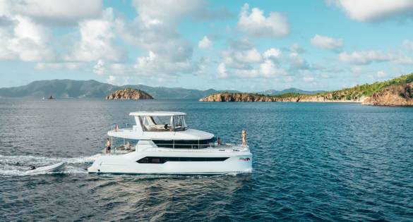
A Power charter vacation provides guests with a unique adventure on the water from the comfort of a private state-of-the-art, high-performance yacht.

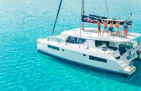
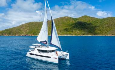
A luxury crewed yacht charter delivers the ultimate all-inclusive vacation on the water aboard your own private sail yacht or power catamaran.
We are proud to offer several types of yacht charter in St Lucia, each providing something unique that will elevate your idyllic vacation. Will you choose one of our rewarding bareboat yacht charters, hire a skipper or opt for ultimate luxury on a crewed charter?
Embrace the freedom to explore the island’s diverse attractions and sailing routes at your own pace on a St Lucia bareboat charter. With no crew onboard, a bareboat charter ensures uninterrupted relaxation and tranquility, and also allows you to take on the responsibility of skippering one of our world-class yachts.
A skippered yacht charter takes the sense of adventure from a bareboat charter, and relaxation from a crewed charter. It truly offers the best of both worlds as you can hire a skipper for all or part of your St Lucia yacht charter.
This means you can take the helm when you want, still charting your own destiny, but can also spend time with friends or family up on deck and let one of our experienced skippers guide you around the majestic islands.
Want to take your St Lucia sailing vacation to the next level? Opting for an all-inclusive crewed yacht charter in St. Lucia ensures a luxurious and stress-free vacation. With a professional crew of skippers, chefs and housekeepers onboard, you can indulge in the utmost comfort, enjoying gourmet meals, personalized itineraries, and attentive care throughout your St Lucia yacht charter.

View our fleet of comfortable, performance monohulls and catamarans. Take the helm or embark with a skipper.

Explore our innovative and industry-leading power yachts.

Discover our world-class Crewed yacht catamarans.
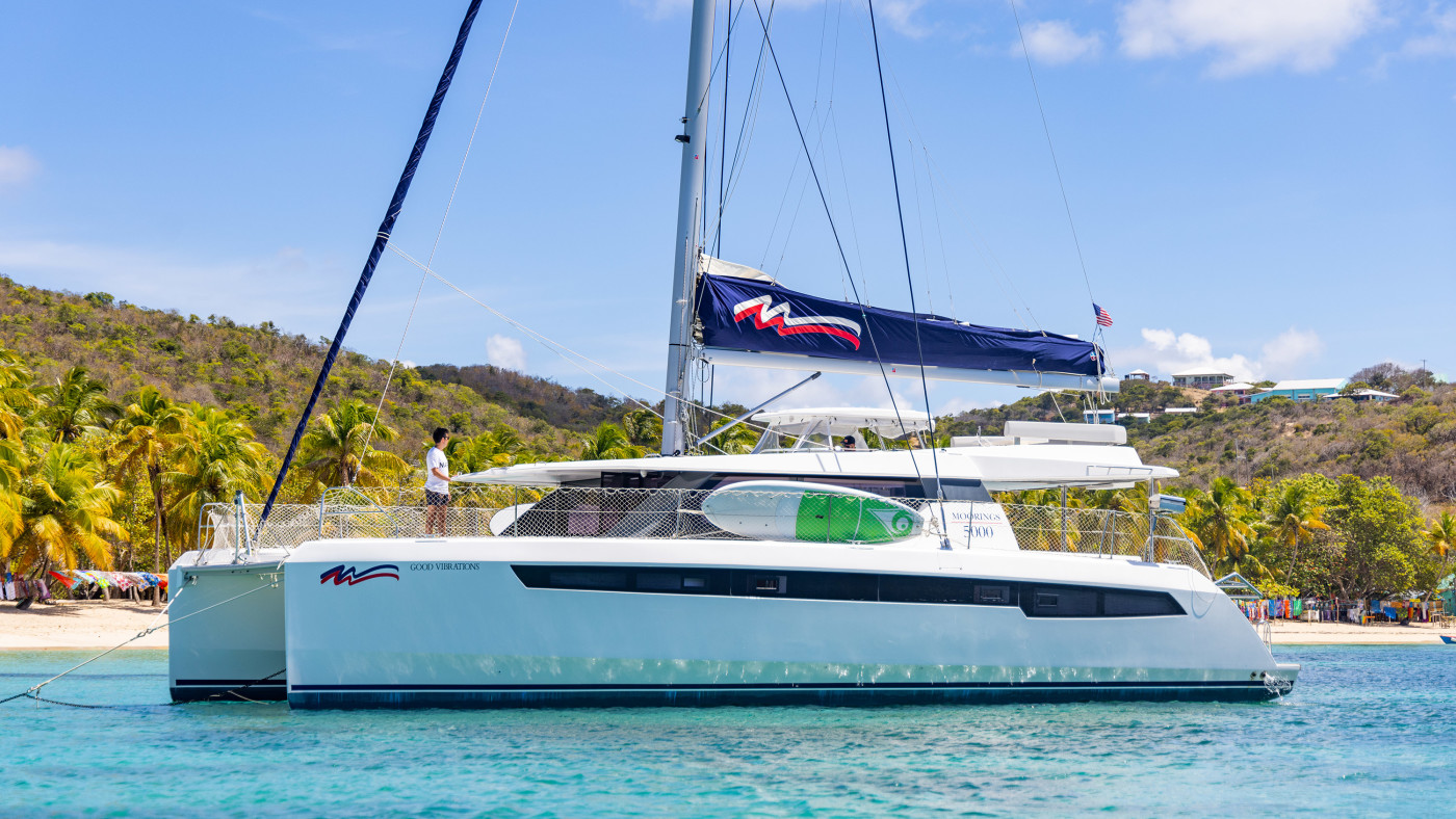
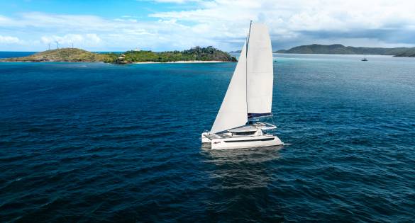
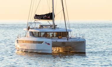
At The Moorings, we understand that the type of yacht you set sail on will have an impact on your overall charter experience. We have spent 50 years building a world leading fleet of cutting edge sailing catamarans, power catamarans and monohulls to provide a seamless yacht charter in St Lucia.Our impeccable sailing catamarans are spacious, modern and stylish, ensuring you enjoy the smoothest possible sailing experience as you sail between St Lucia and its surrounding islands.
High-performing, technologically advanced and fuel-efficient, take sailing in St Lucia to a new level when you climb aboard a power catamaran charter with The Moorings.
A modern take on the classic monohull, our state-of-the-art monohulls are comfortable, easy to handle and the ideal sailing companion for a St Lucia yacht charter.
the perfect platform for an unforgettable vacation.
Classically refined and contemporarily equipped, our monohulls set the standard for performance and comfort. Backed by the boat-building heritage of Beneteau, these vessels are some of the most sought-after charter yachts available. Come and experience sailing tradition—with new adventures.

Save 10% on your next Crewed Yacht Charter
Book a 7 day charter in paradise and get one day on us
Book your charter in advance and save up to 10%


The Windward Islands promise lively sailing conditions, with a St Lucia yacht charter experiencing brilliant winds, sizzling sunshine and straightforward navigation.
Forming the eastern border of the Caribbean Sea, the Windward Islands’ north-south orientation means the winds will be on the beam more often than not when traveling south on your St Lucia boat charter. This is ideal for fast cruising on the longer passages between some of the islands and a great option for those considering where to sail in fall.
Heading north, cruising close-hauled or on a close reach is typical while those that opt for a one-way charter can cover more ground and avoid moving windward. Wind velocities run the gamut from a gentle 10 knots to a more spirited 25 knots, often strengthening off the northern ends of the islands due to land effect.
Navigation is straightforward, which makes a St Lucia yacht charter ideal for all sailors, whether you have been riding the waves for years or are planning to take the helm for the first time on a bareboat yacht charter. Of course, plotting courses and keeping an eye on the GPS is still very important during your sailing vacation in St Lucia.
Learn more about the brilliant cruising conditions in St Lucia, from the average annual temperature to tidal range.
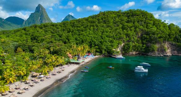
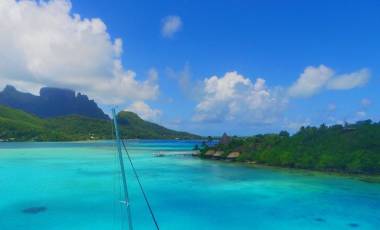
From the exceptional cruising conditions to the opportunity to uncover the wonders of islands only accessible by boat, there are countless reasons why you should charter a yacht in St Lucia. Whether you’re enjoying the sights of your St. Lucia yacht charter from the deck of your boat, in the water, or on land, there is no doubt you will be captivated by your surroundings. Historic sites and lush landscapes are the backdrops to beaches suited for swimming, windsurfing, kayaking, snorkeling, and scuba diving.
If you’re wondering when to experience St Lucia at its finest, April offers ideal sailing conditions, pleasant temperatures, and vibrant island life. Learn more about the best places to sail in April.
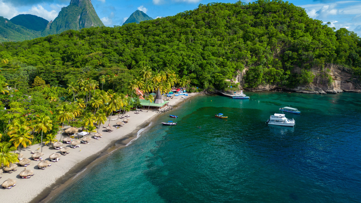
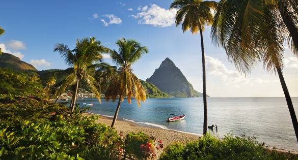
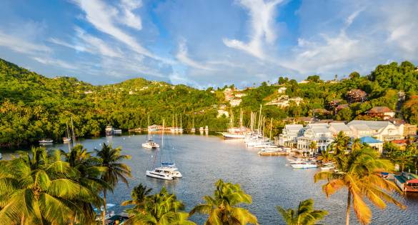
Around the island, you will discover natural beauty in places such as Marigot Bay and the stunning Pitons to the south. When you’re not cutting through the surf on your yacht or relaxing on some of the best beaches in St Lucia, you may want to take advantage of the many sightseeing opportunities on land while hiking, shopping, or simply taking in the scene from a table at a quaint shorefront restaurant. St Lucia is abundant with flora, including wild orchids and giant ferns. Look for the tropical birds while hiking the island’s curving trails and pathways. A popular attraction that shouldn’t be missed is the nearby Soufriére volcano where you can hike to the crater and learn about the volcano’s impact on the island.
There are so many ways to explore St Lucia and the sensational surrounding islands that we have created multiple itineraries that you can choose from or take inspiration from when designing your own St Lucia sailing itinerary.
If you do follow one of our carefully crafted routes, you can expect to sail to and around some of the following places:
These are only a few of the beautiful islands, cays and bays you can expect to visit on a St Lucia boat charter with The Moorings.
If this is your first time planning an exciting St Lucia yacht charter, you’ll likely be wondering about the best time to sail, as well as any times of the year to avoid.
In St Lucia, the dry season runs from February to May, while the wet season is classed as June to September. Hurricane season technically lasts from June to November, with the peak being around August and September.
St. Lucia’s steady trade winds and tropical climate make it an ideal early winter sailing destination. That’s why it’s featured in our guide on best Caribbean sailing locations for November.
The peaking sailing season in St Lucia is between mid-December-mid-April. A prime time for a St. Lucia yacht charter is during the winter months when a cool northeast wind blows across the shores. Although, if you’re looking for a more secluded, quiet yacht charter in St Lucia, you may choose to go between May and June instead.
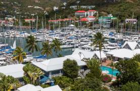
You can spend your St Lucia yacht charter doing whatever makes you happiest, even if that means spending the entire week in St. Lucia waters, using Rodney Bay as your base to enjoy leisurely sails and sojourns ashore to shop, sightsee, and sample gourmet fare in upscale restaurants.
However, for most charterers, the attraction of the Eastern Caribbean is the chance to combine open-water, down-island trips in fair winds with pleasant days of short passages between islands to swim, snorkel, and experience the culture and ambience of the smaller isles in the magnificent Grenadines just south of St. Vincent.
The islands, cays and bays featured on our St Lucia sailing itinerary are easy to sail between, and the wonders you’ll find when you reach each one is well worth it anyway. The longest passage you’ll encounter during your yacht charter in St Lucia is between St. Lucia and St. Vincent, and beyond are myriad islands in a tropical paradise.
From the Windwards to the Grenadines and beyond, a St Lucia yacht charter gives you the ideal opportunity to explore countless Eastern Caribbean destinations. With this in mind, the length of your St Lucia sailing vacation will depend on how many destinations you want to visit, how much downtime you want to have and how many excursions you have planned.
We have a mixture of 7-day, 10-day and 14-day sailing itineraries for St Lucia, each of which bring something unique and exciting. Take a look at our itineraries and decide which one works best for you. It is worth keeping in mind that our itineraries require you to clear customs. Further details will be provided to you during your chart briefing at the base.
Spend your afternoon swimming, snorkeling, kayaking and splashing around in the crystal clear waters of St Lucia. Check out our water sports options to learn about what you can add to your charter.
St. Lucia has a stunning tropical climate that is influenced by sea winds and the prevailing NE trade winds. The winds are nearly always from northeast to southeast at 10 to 25 knots, and tend to strengthen around the northern ends of the islands. Sea state in the passages between the islands can be moderate, but rarely rough.
St. Lucia’s temperature ranges from 65 to 85°F (18 to 29°C) from December to May and 75 to 95°F (23 to 35°C) from June to November. The Winter is relatively drier as well. Average annual precipitation varies from 1,500 mm to 1,750 mm (59 to 68 inches) on the north and south coasts to 4,000 mm (157 inches) in the interior rainforest. Water temperature is fairly constant at 83°F (28°C).
Our St Lucia yacht charter base provides a weather forecast for the following 24 hours upon arrival. There are locations at Blue Lagoon St. Vincent, Tyrell Bay, Clifton Harbor and Bequia where forecasts are posted daily. Please note that radio reception can be very poor in the islands but you can obtain reports during your St Lucia sailing vacation by calling our Moorings base by cell phone.
In the Windward Islands the tide range is very small: 30 cm to 60 cm (1 to 2 feet) including the variation of level due to atmospheric pressure and dominant winds. You will experience similar tidal ranges at some of our other incredible Caribbean destinations in the BVI and Grenada, as well as our Mediterranean charter bases in Greece and Italy.
If you’re wondering about the current during your St Lucia yacht charter, the current between the islands is generally setting towards the west at about 0.5 to 2 knots and the swell is mainly northeast to east, but can occasionally be north during the winter months.
Exclusive Plus – Exclusive Plus class yachts are up to 1 year old, and feature the latest innovations and complimentary WI-FI in British Virgin Islands, Thailand, Seychelles, and all Mediterranean locations (excluding Italy).
Exclusive – Exclusive class yachts have been in our fleet approximately 1 to 3 years and feature many of the same amenities as our Exclusive Plus yachts as well as complimentary WI-FI in British Virgin Islands, Thailand, Seychelles, and all Mediterranean locations (excluding Italy).
Club – Club class yachts have some of the Exclusive class amenities, and are generally 3+ years of age (up to 10 years in the Exotics and Mediterranean) .
Yes! Perfect for couples or singles, you can enjoy the experience of a Luxury Crewed Charter for the price of a single cabin.
The Moorings is proud to announce that Free Wi-Fi is now included on all Exclusive and Exclusive Plus models, and all-inclusive Crewed Yachts in select
destinations worldwide*, including the British Virgin Islands, Thailand, the Seychelles, and all Mediterranean locations (excluding Italy). Wi-Fi is also available for rent on our Club model yachts in participating destinations.*Internet connectivity and speed may vary within cruising grounds.
The Moorings carries the most up-to-date equipment and all the extras a sailor or powerboater could ask for, including GPS satellite navigation
systems, autopilots, The Moorings SailMate mainsail stacking system and CD players with cockpit speakers. Some even have generators and air conditioning. The below deck areas are modified from standard factory production models to give you more room, comfort, and luxury. Our newest models include flatscreen TV’s and DVD players
Start your experience with The Moorings on land and sign up to receive e-mails from us about yachts, offers and destinations.
By clicking 'Sign up' you confirm that you have read and understood our Privacy Policy and consent to our use of your information.